
Difficulty: Easy (1 steep ascent on stone steps and back down the same way)
Length: Approximately 1.7 miles
Max elevation: 1,387 ft.– total elevation gain approximately 281 ft.
Route type: Out and back
Trailhead parking: Shaft 2A Road Wawarsing, NY 12446
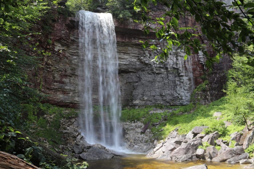
For decades Stony Kill Falls had been a secret gem known to locals and avid tourists of the famed Shawangunk Ridge. Hidden in the southwest flank of the Minnewaska State Park Preserve, a towering 87 foot drop swelled every Spring into a roaring waterfall with no official access route. Gated off at the end of an unassuming road with the unappealing name of Shaft 2A Road, only those in the know, knew where to go.
Continue reading “Stony Kill Falls Copy”